
Chester history · AD 74 to now
The Chester City Walls
The most complete circuit of Roman and medieval city walls in Britain — nearly two miles of walkway, still doing the job of showing you the city.
Plenty of English towns have fragments of wall. Chester has the whole thing: a continuous elevated walkway of about 2.95 kilometres — one and four-fifths of a mile — running round the historic centre, with only a short break on the southern side. It is a scheduled monument, and the walls, towers and gates are almost entirely Grade I listed.
It is also the single best thing to do in Chester, and it is free. An hour and a half at a gentle pace will show you the cathedral roofs, the racecourse, the canal in a rock cutting, the Roodee, the river and a good deal of what the city has done to itself over two thousand years.
The short version
The Roman wall
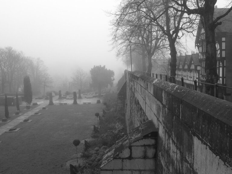 Photo: Tom Axford 1 (CC BY-SA 4.0), via Wikimedia Commons
AD 74 to the fourth century
The first defences went up with the fortress itself in AD 74–75, when Legio II Adiutrix arrived: an earth rampart with a timber palisade, enclosing about 25 hectares. Around AD 100 the Twentieth Legion began replacing it in local sandstone, and the job took the best part of a century to finish.
Two stretches of the northern and eastern walls still stand on Roman foundations, and in places the Roman masonry itself survives several courses high — look on the north side, between the Northgate and King Charles Tower, where the change in stone is obvious once you know to look for it. The Roman circuit was a rectangle. The medieval one is not, which is the clearest evidence of what happened in between.
The medieval extension
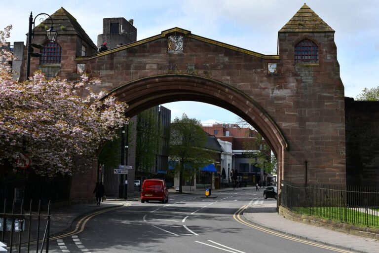 Photo: Michael Garlick (CC BY-SA 2.0), via Wikimedia Commons
1070–1162
After the Norman conquest the walls were extended south and west to bring the castle and the river frontage inside the defences. The Watergate, the Shipgate and the Bridgegate were in place by the 1120s, and by 1162 the full circuit as we have it was complete. What had been a rectangular fortress became an irregular enclosure shaped by the Dee.
That extension is why the walk feels so varied. The northern and eastern sides are essentially Roman in line and military in feel; the southern and western sides run along a river cliff and past the racecourse, and are much more of a promenade. The Newgate, the arch you cross near the amphitheatre, looks convincingly medieval and was built in 1938.
The four gates
None of the main gates is medieval. All four were rebuilt in the Georgian period, when the city wanted carriages to get through.
The Eastgate was rebuilt in 1768 and is the one everybody photographs, though what they are actually photographing is the clock added on top in 1899. The Bridgegate followed in 1781, the Watergate in 1788, and the Northgate between 1808 and 1810, replacing a structure that had contained the city jail.
The lost gate is the Shipgate, which opened onto the ford across the Dee. The stretch of wall containing it was pulled down in the early nineteenth century to make room for a new gaol yard, and the arch itself was moved in 1831 to the south-west corner of Grosvenor Park, where it still stands.
Towers and curiosities
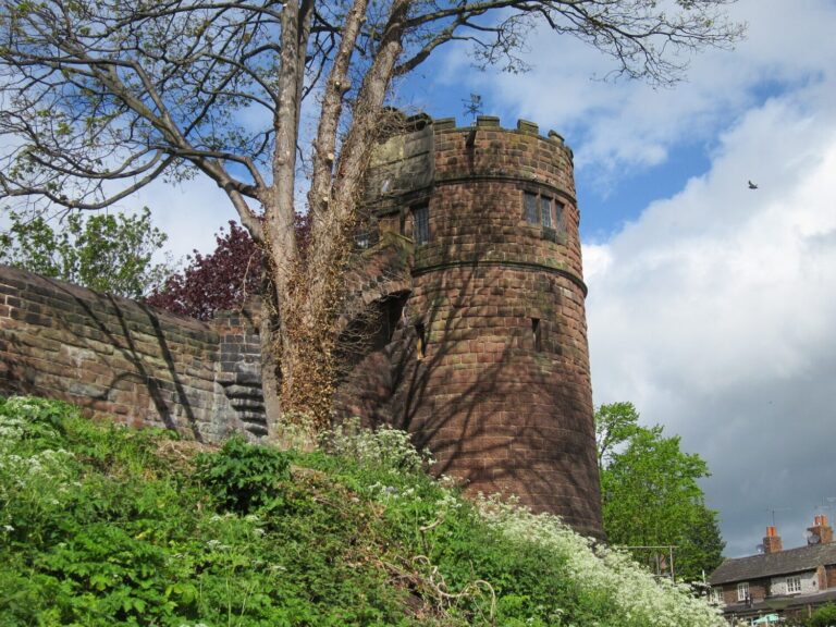 Photo: Jeff Buck (CC BY-SA 2.0), via Wikimedia Commons
What to look out for as you go round
King Charles Tower, also called the Phoenix Tower, sits on the north-east angle. Tradition has Charles I standing here on 24 September 1645 watching his cavalry destroyed at Rowton Moor; it now holds a small display on the siege. Further east are Thimbleby’s Tower and Barnaby’s Tower.
On the north side, Morgan’s Mount is a small gun platform with a view over the canal, and Pemberton’s Parlour is a semicircular shelter where a rope-maker is said to have watched his workers in the Roodee below. At the north-west corner, Bonewaldesthorne’s Tower is joined by a spur wall to the Water Tower, built in the fourteenth century to guard a harbour that has since silted up and become dry land — a good illustration of how far the river has moved.
On the south-eastern side, the Wishing Steps of 1785 come with the usual instructions: run up, down and up again without drawing breath and your wish is granted. Nobody has ever verified this.
The canal cutting
The strangest stretch is on the north side, where the Shropshire Union Canal runs in a deep rock cutting immediately below the wall. The Chester Canal was cut in 1772 and the engineers took it straight through the sandstone the Romans had quarried the wall from, so you walk along the top of a Roman defence looking down at a Georgian one. The Bridge of Sighs, a narrow footbridge of 1793, crosses it near the Northgate; it carried condemned prisoners from the jail to the chapel.
Keeping it standing
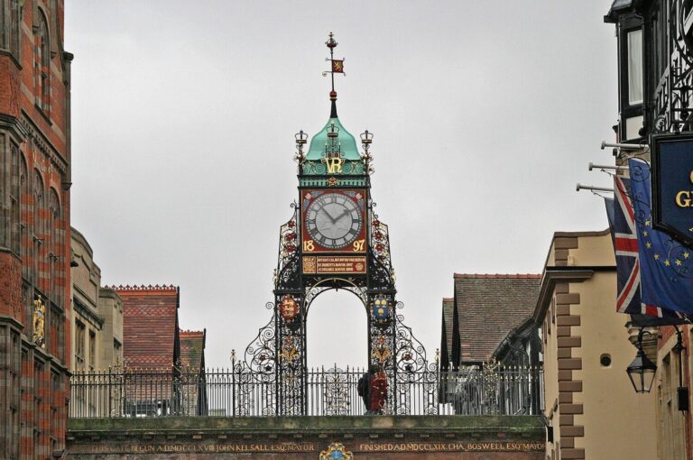 Photo: W. Bulach (CC BY-SA 4.0), via Wikimedia Commons
A two-thousand-year maintenance problem
A wall this old in soft sandstone needs constant work. A section near the Eastgate collapsed in 2008 and reopened in 2010; a stretch between Morgan’s Mount and the Northgate has had long closures for movement in the fabric; and in January 2020 part of the south-eastern wall came down during nearby development work.
Cheshire West and Chester Council secured and stabilised the 2020 collapse, threaded a temporary walkway through the scaffolding so the circuit stayed open, and programmed the main repairs to run from autumn 2025 to the middle of 2026. Short diversions come and go, so it is worth a look at the council’s walls page before you set out if you want to do the full loop.
The other complete circuit
Chester is usually described as having the most complete circuit of city walls in Britain, which is fair — but it is not the only walled town within an hour of the city, and the comparison is worth making because the two are historically connected. Conwy, forty-five miles west along the North Wales coast, was walled between 1283 and 1287 as part of Edward I’s conquest of Wales: 1.3km of curtain wall enclosing about 25 acres, with twenty-one surviving towers and three gateways, built as one planned scheme alongside the castle for a combined cost of somewhere near £15,000.
The Chester connection is not incidental. The labour force for the Welsh castles was massed at Chester each summer before being taken west for the building season, and the western stretch of Conwy’s walls was supervised by Richard the Engineer — the same Richard Lenginour who worked on the choir of Chester Cathedral — as second-in-command to Edward’s chief architect, Master James of St George. Chester was the assembly point and the arsenal; Conwy was where the money went.
Conwy’s castle and walls have been a UNESCO World Heritage Site since 1986, and like Chester’s the walls are walkable. If you have done the circuit here, the walk round Conwy’s town walls is the obvious sequel: a tighter, steeper, frankly more military circuit, put up in four years rather than accumulated over nineteen centuries.
Walking it
Start anywhere; the Eastgate is the obvious place because it is the middle of the shopping streets, and going clockwise gets the busiest section out of the way first. Allow an hour and a half with stops. There are steps up and down at every gate, so it is not step-free, but the walkway itself is broad and even for most of its length.
The best light is late afternoon on the western side, looking over the Roodee. The best single view is from the north-east angle by King Charles Tower, where you can see the cathedral, the canal and the Welsh hills in one turn of the head.
Keep reading
More Chester history.
Roman Chester · The Siege of Chester · The Chester Rows · All history
Photographs are reproduced under Creative Commons licences; the photographer and licence are credited beneath each image.
Hero photograph: habiloid (CC BY-SA 2.0) via Wikimedia Commons